 |
| A Happy Hiker. |
View Larger Map
Starting at the Smuggler's Brewpub on the corner of Pine St and San Juan Ave is ideal for reasons that should be obvious, but will become clear later. I ran this loop (and hiked it last year) in a clockwise direction. I will point out in a few places why I think this also is ideal.
The first two miles run along the San Miguel River and are relatively flat, allowing one to ease into the task ahead. And the task ahead is obvious. Once out of town, the first major obstacle is clear, the climb up to the top of Bridal Veil Falls.
 |
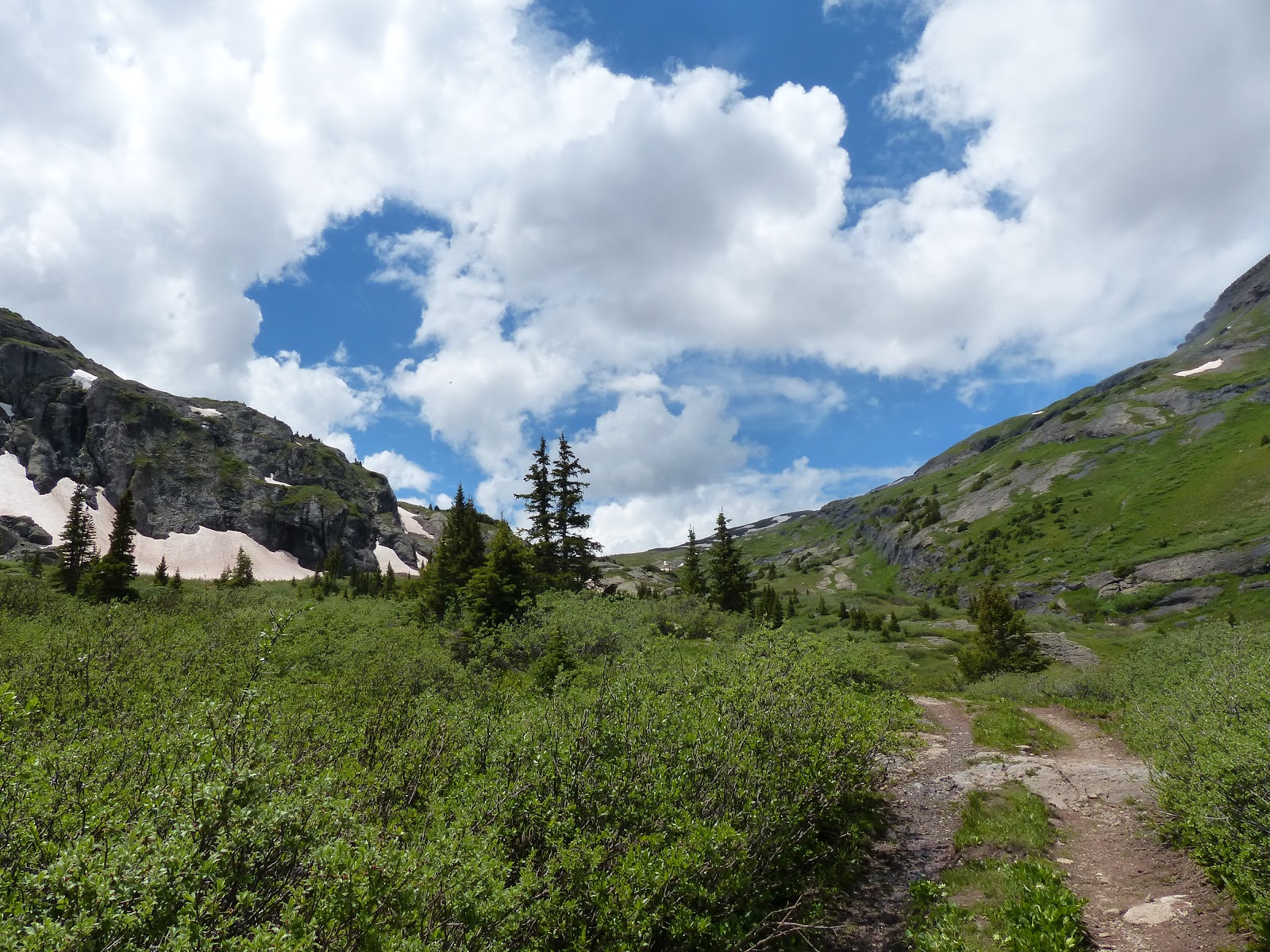
| A mile into the run, you can see where you need to climb to, the top of the falls, using the switchbacks to the left of the falls. |
 |
| The falls had a lot more water coming over them than last year. The cooling mist was godsend early into the run. |
From Pandora Mine to the top of the falls is 2.6 miles and nearly 1300 vert of climbing. But the view is worth the effort.
 |
| Still a little mist left on the lens when I took this shot from top of Bridal Veil Falls. |
The scenery did cause me to stop a number of times to take it in and take pics.


As you continue to climb up the Basin, fewer people are seen, until you basically have the place to yourself. And, it got a little cooler. Perfect temp for running. This is one reason I like doing the loop this direction, get the hottest section done earliest. And if you get out earlier than 10:30AM, then you never really have to deal with heat to much. The grade of this climb up the basin is also nearly perfect, generally runnable, with some small steeper sections that require power hiking.
As I reached the upper portions of the basin, route finding became more difficult. Last year, I ultimately took a wrong turn. This year I was aware of that, but snow patches did slow things up, and finding the trail thru the snow, slowed things up.
 |
| Snow in the upper basin made route finding a little more difficult and did slow the run down a bit. |
Eventually I reached the saddle below Wasatch Mtn and was ready to run down the Bear Creek drainage.
 |
| Which Way Do I Go? |
This is part of the run is also part of the Hardrock 100 course, to be run this coming Saturday. It was the 2nd time I had been on the course this weekend.
 |
| Hardrock 100 course markers made the descending thru snowfields easier to manage. |
The initial descent is pretty steep. At the top of the pass, you are at 13 090 feet. In the first mile of descending, you lose 800 vert feet. Then another 700 vert feet the next mile, followed by 900 vert feet the next mile. I much rather descend that, than climb it. Another reason to run clockwise.
 |
| Descending into the Bear Creek drainage |
Another reason to run clockwise, is it allows for a wonderful add on if you are feeling good and want more miles. Unfortunately, do to my late start, I didn't think I had the time to do so. But one can climb out of the Bear Creek drainage to the top of the Gold Hill lift and descend back into town by way of the Telluride Ski Resort trails. I suspect this would add on at least 5 miles to the run, depending on how you climbed up and descended. It also would add on close to an hour and half to the run. That is why I skipped out. (along with the fact I was out of water, and my filter was clogged) But next year, I am going to add in the climb.
The single track trail eventually meets the double track Bear Creek Trail and the grade lessens to make for a nice last couple of miles into town. Of course, there are a lot more people to dodge again as you get closer to town.
On return trip back to Boulder made stop at Colorado Boy Brewing in Ridgway and then Elevations Brewing in Poncha Springs. Highly recommend both. Many tail wags for both these places.
Finishing in town, the loop was 15.1 miles. 4300 feet of climbing and then 4300 of descending. Total time running 3:26. (total time with rest breaks, generally picture breaks 3:52). After a quick splash in the San Miguel River to clean up and feel slightly refreshed it was time for a Coke, beers, burger and fries. Hence why the start/finish spot is at the Smuggler's Brewpub. They brew some decent beers. Telluride Brewing Co makes better beer in my opinion, but unfortunately aren't in old town Telluride proper (plus no food, and due to weird city regulations, no seats in their taproom). But Smugglers does have some good food. A little pricey, but that is the cost of doing business in Telluride. Anyway, a solid place to reload after a solid run. Plus the outdoor seating is nice as well.
This is the 2nd 4th of July weekend in Telluride and it might become a tradition. On Friday hiked the Swamp Canyon trail (also a part of the Hardrock course), near Ophir. First time thru Ophir. Beautiful little settlement. On Sunday hiked Deep Creek Tr / Whipple Mtn Tr / Iron Mtn Tr on the north side of the Telluride valley (above the airport). And again, camped out by Alta Lakes, a phenomenal spot. Tried to see the fireworks by hiking up from campsite to the top of Prospect Basin (in the Telluride Ski area), but fireworks didn't clear high point at top of Apex Lift. Still was great way to spend the evening. Had a few beers. Relaxed. Enjoyed the sunset. Startled some elk. It is weird to have the top of a ski mountain all to ones self. The stillness and quiet is such a contrast to winter when this spot is usually crowded with people.
 |
| Drew and I enjoying a beer atop Telluride Ski Resort. |
On return trip back to Boulder made stop at Colorado Boy Brewing in Ridgway and then Elevations Brewing in Poncha Springs. Highly recommend both. Many tail wags for both these places.
So for all pictures from the weekend, click below
https://plus.google.com/photos/106597417627187460452/albums/6033518874918120193
For stats/details of run click below
http://tpks.ws/m5UM
For stats/details of run click below
http://tpks.ws/m5UM

No comments:
Post a Comment