If you want to skip the details and just go to photos here is the link:
https://goo.gl/photos/o7jtGztAs4qfixA67
But if you want all the gory details of a very long day, continue reading:
This week marked my 10 year anniversary of moving to Colorado. To celebrate, I wanted to climb a 14er. I initially had thought about doing the Mt. Belford / Mt. Oxford combo, as I hadn't reached Oxford's summit my previous time climbing Belford. But with the Leadville 100 trail race going on this past weekend and all the traffic from the support crews, I decided that it was a better idea to stay away from the Winfield area, so decided on Mount of the Holy Cross. This would be my 26th 14er, almost halfway there and Rusty's first. Fittingly, Laurie, one of the first friends I made after moving to Boulder was going to join me. It also turned out another one my friends already was planning on doing that same hike and she and a group of her friends had a campsite reserved near Vail. Seemed like a nice convergence of events. So there would be 4 of us on the hike along with Rusty.
Drove to Vail Friday evening, arriving at the campsite around 8 pm. Set up camp. Chatted a bit, then headed to bed for an early morning wake up.
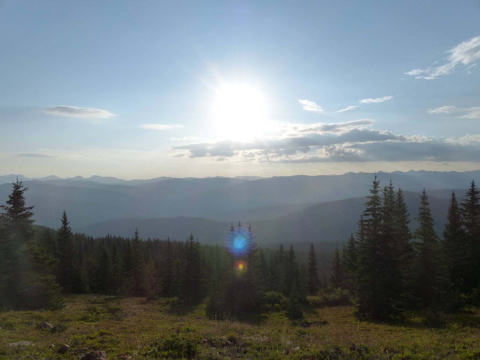
Woke up early Saturday morning, with goal of being on the trail before 6:30 am. Saw a young moose on the drive to the trailhead. Seemed like a good sign of things to come. Weather was pretty good. Ended up actually starting the hike closer to 7 am.
 |
| 8th Wilderness Area I have visited in my 10 years in Colorado |
The initial climb up Half Moon Pass went quickly and got some nice views of sunrise.
As we descended down the pass to East Cross Creek, there was a light rain that fell briefly. The sky was fairly cloudy, and I thought this might be a less than ideal weather day. The forecast called for it being windy, but said nothing about early morning rain.
But as we got our first views of Mt. of Holy Cross on the descent, the sky began to clear up a bit.
 |
| View of Mt of the Holy Cross as we descended down Half Moon Pass to East Cross Creek. |
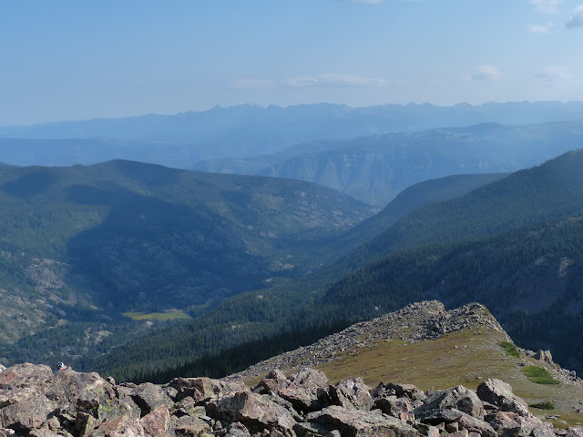
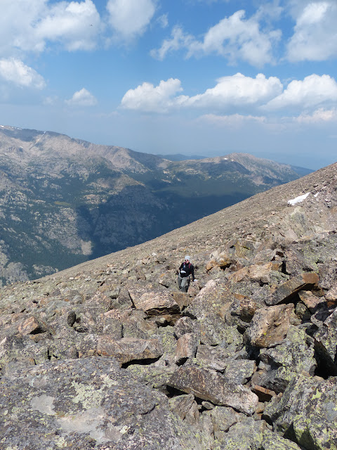
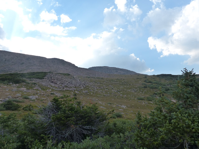
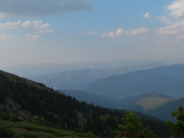
3 miles in we crossed the East Cross Creek and now began to climb. We basically had gained no overall elevation from the trailhead. The next 2.5 miles to the summit would require gaining 3300 vertical feet. As we got above treeline, the views were spectacular. With the wildfires in the west, our skies in Colorado have been hazy lately. This picture looks towards Minturn. On a clear day, the back bowls of Vail should be clearly seen. Hard to make out with the haze.
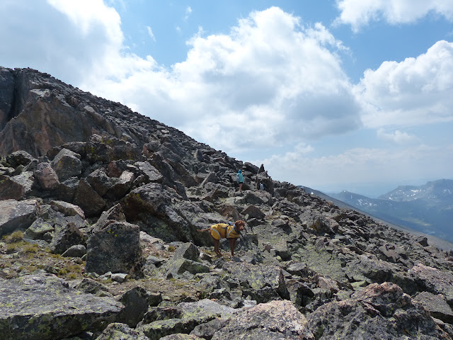
Rusty was a real trooper, leading the way up the climb.
 |
| Hurry up guys. |
 |
| Looking back down the Cross Creek valley. Back bowls of Vail are slightly visible in the upper right. |
 |
| The crew takes a break on the way up. |
As we climbed higher, the wind picked up. It was a bit of tough day, in that, I felt like I was constantly putting on a layer, then having to take it off, then put it back on. With a fair amount of clouds, it was constantly blocking the sun and then clearing back out. That kept fluctuating the "feel" temperature. If the clouds were blocking the sun and we were exposed to the wind, it was chilly. If we were protected from the wind and the sun was completely out, it was quite pleasant. So it was a day where layers were constantly being put on or taken off.
 |
| Our objective, the summit of Mt of the Holy Cross |
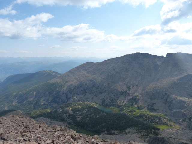 |
| Looking down on Lake Patricia |
 |
| The group, along the multitude of others on the trail. |
 |
| First view of the Bowl of Tears. |
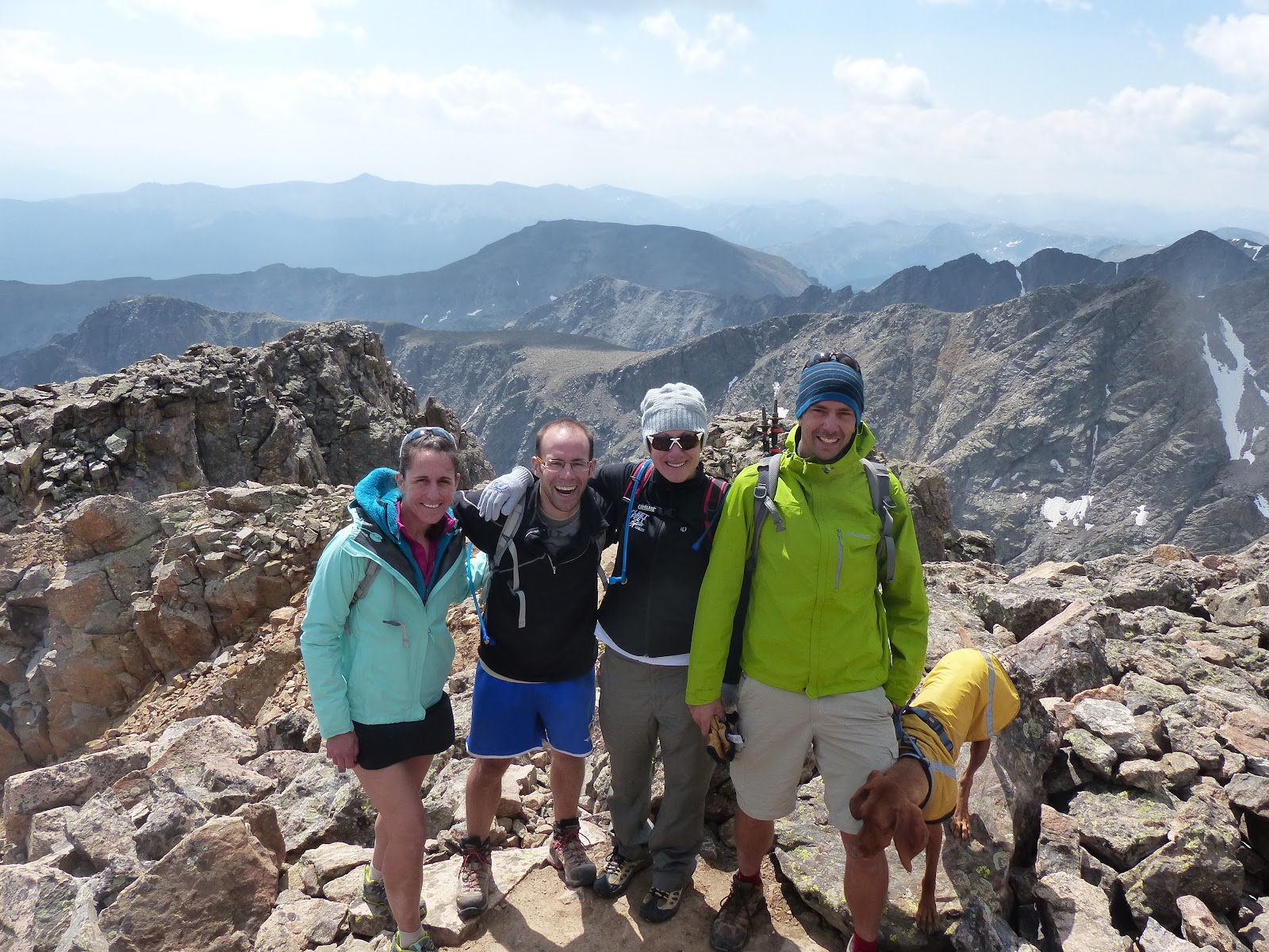
After a little over 4 hours, we reached the summit. 14 005 feet above sea level.
 |
| Trust me, it is 14 005 feet even though the marker doesn't have it etched. In fact most markers I have seen don't have the elevation listed. |
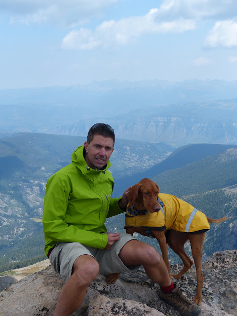 |
| This was the best of series of pics. Rusty was a bit too excited about his first 14er to sit still. |
 |
| Lake Patricia. Much higher up this time. |
 |
| Beers at the summit. |
 |
| The gang. Shannon, Weston, Laurie, myself and Rusty at the top. |
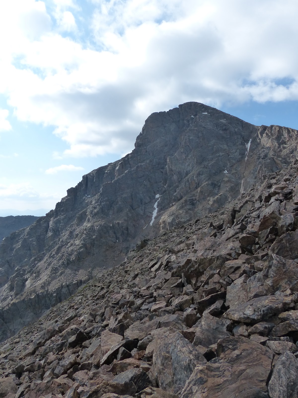
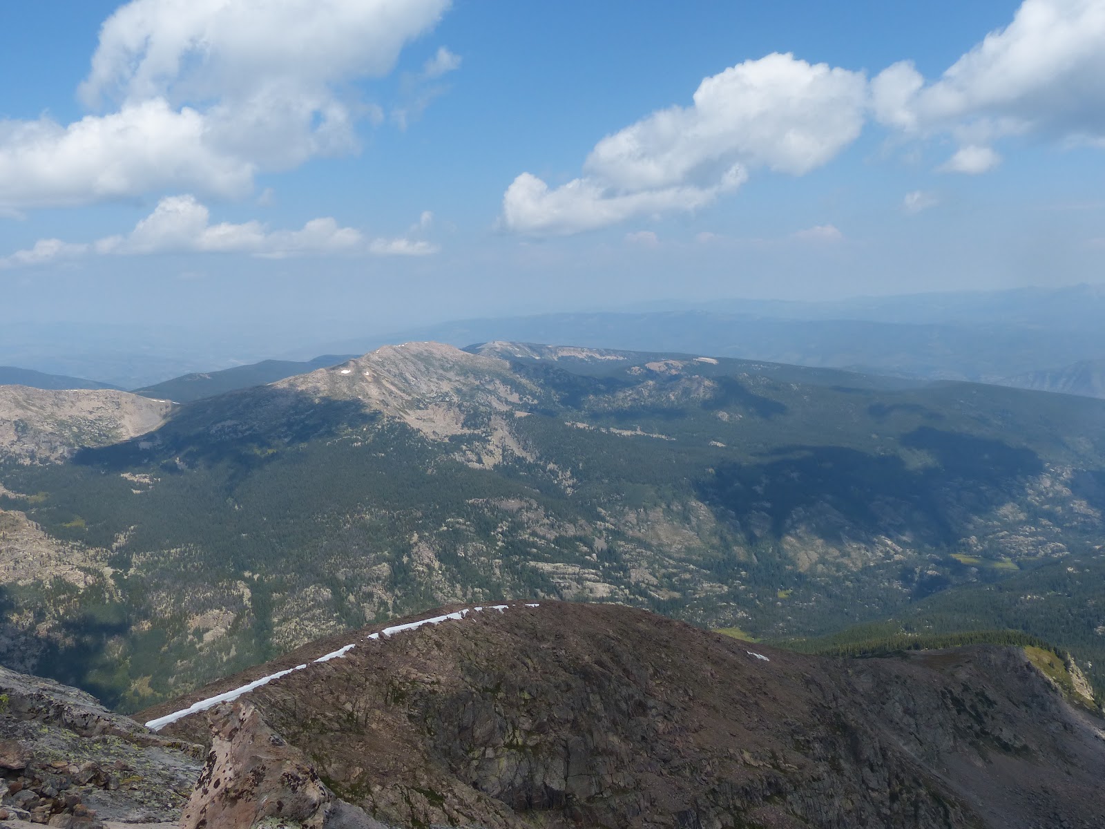
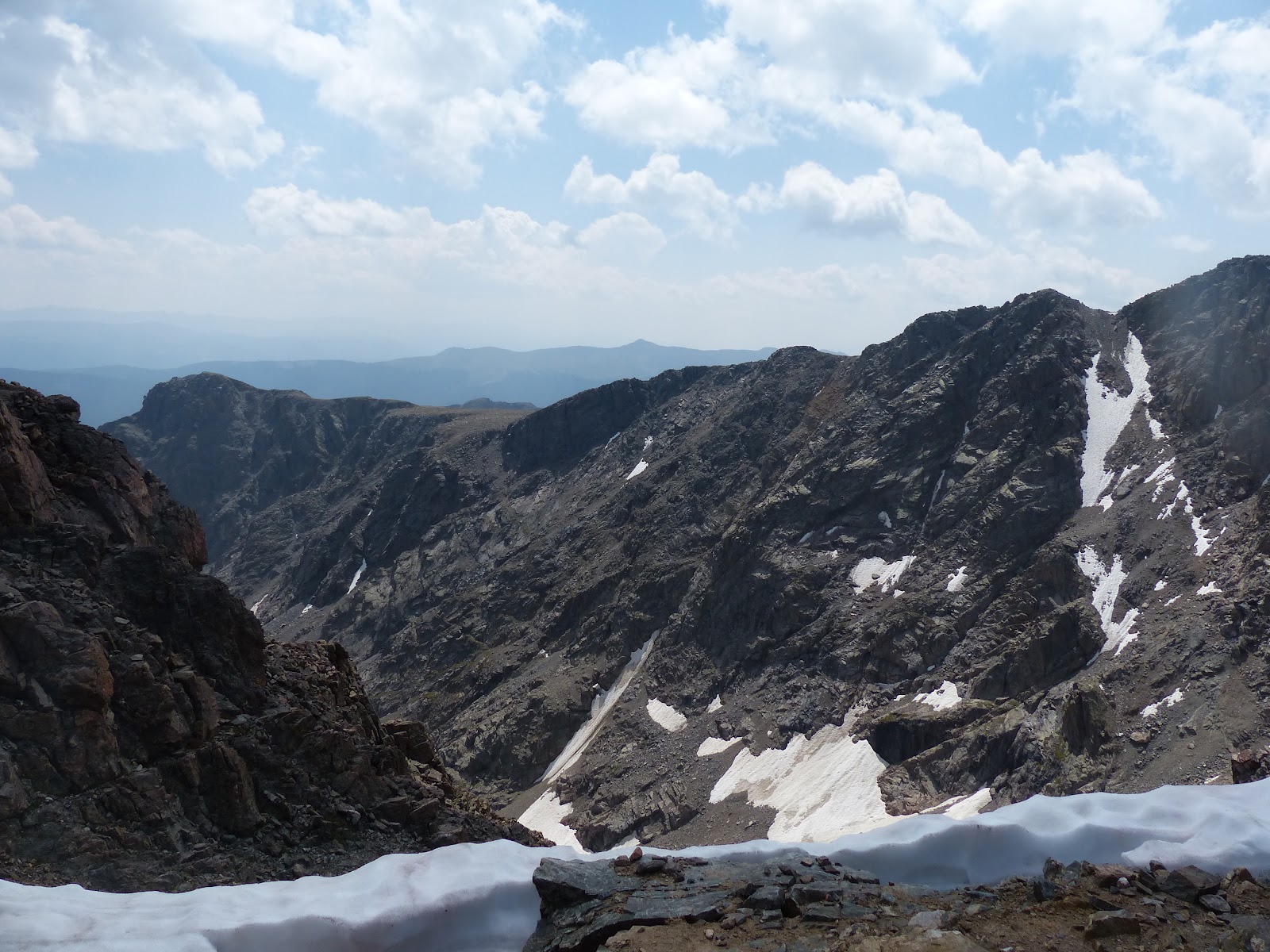
After hanging out at the summit for nearly an hour (which I hadn't realized, only thought it was 30 minutes), we continued on. The idea was that if the weather was good, we would not descend the same way but continue around the Halo Ridge and do a full loop. The hike would be a bit longer mileage wise, but we wouldn't have to climb back up and over Half Moon Pass. Also, since it wasn't the standard route, there would be far fewer people, so a little more solitude. The route we would take is visible behind us. We would be following along the ridge line. It was supposedly only 3 miles to the Notch Mountain Shelter, where a trail then led off the ridge and back to the trailhead. The route description mention talus, but I figured it would only take 2 hours to cover that much ground. In the background of the group shot at that summit, you can see the ridge line we would have to follow.
 |
| The lines/arrows show the ridge line we would trek along to get to the Notch Mountain Shelter |
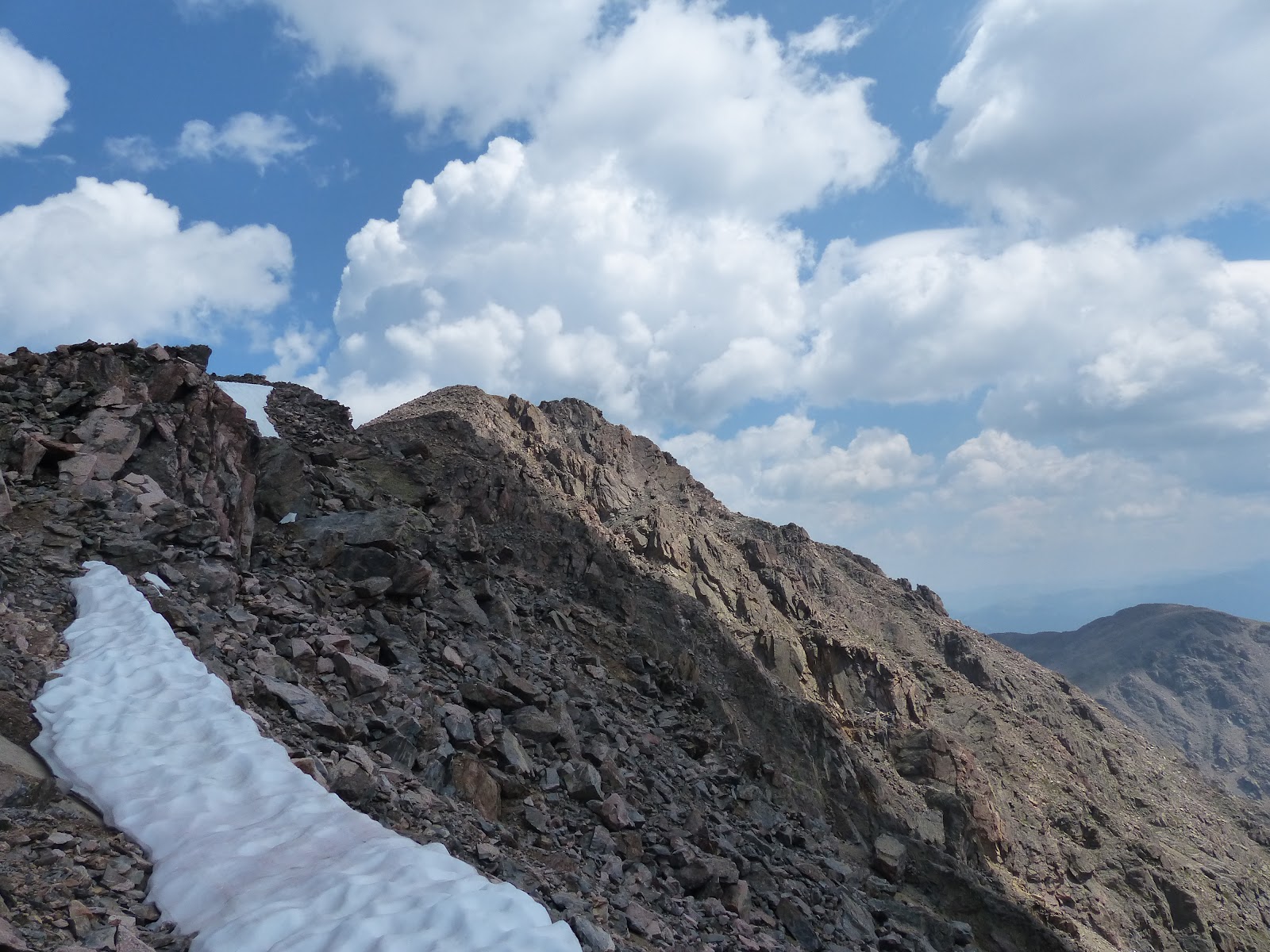
So we descended off the summit and headed on our way. Route finding would be an issue since we hadn't climb up this way and it wouldn't be a defined trail, but I figured there would be cairns to help along the way.
 |
| View of the ridge line we would need to traverse. |
 |
| Looking back up at the summit of Holy Cross |
 |
| Ears blowing in the wind. |
 |
| Route finding through the rocks. |
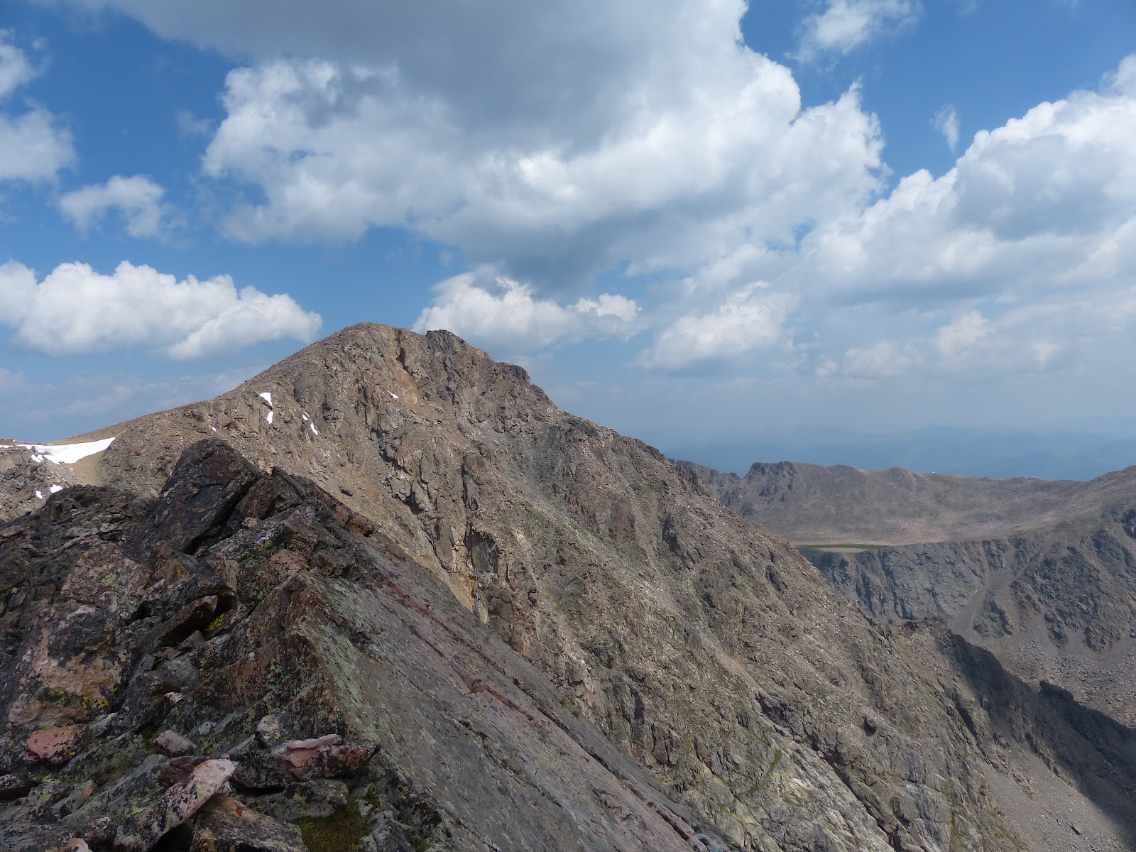
Along the way we would circumvent Unnamed Peak 13831, one of Colorado Centennial's (the 100 highest peaks).
 |
| PT 13831 |
The route around PT 13831 was all talus. We didn't realize it at the time, but this would be pretty much what we would have to deal with the rest of the day. There also weren't any cairns and besides on occasional one, wouldn't be any the rest of the day.
 |
| Laurie trekking through the rocks. |
 |
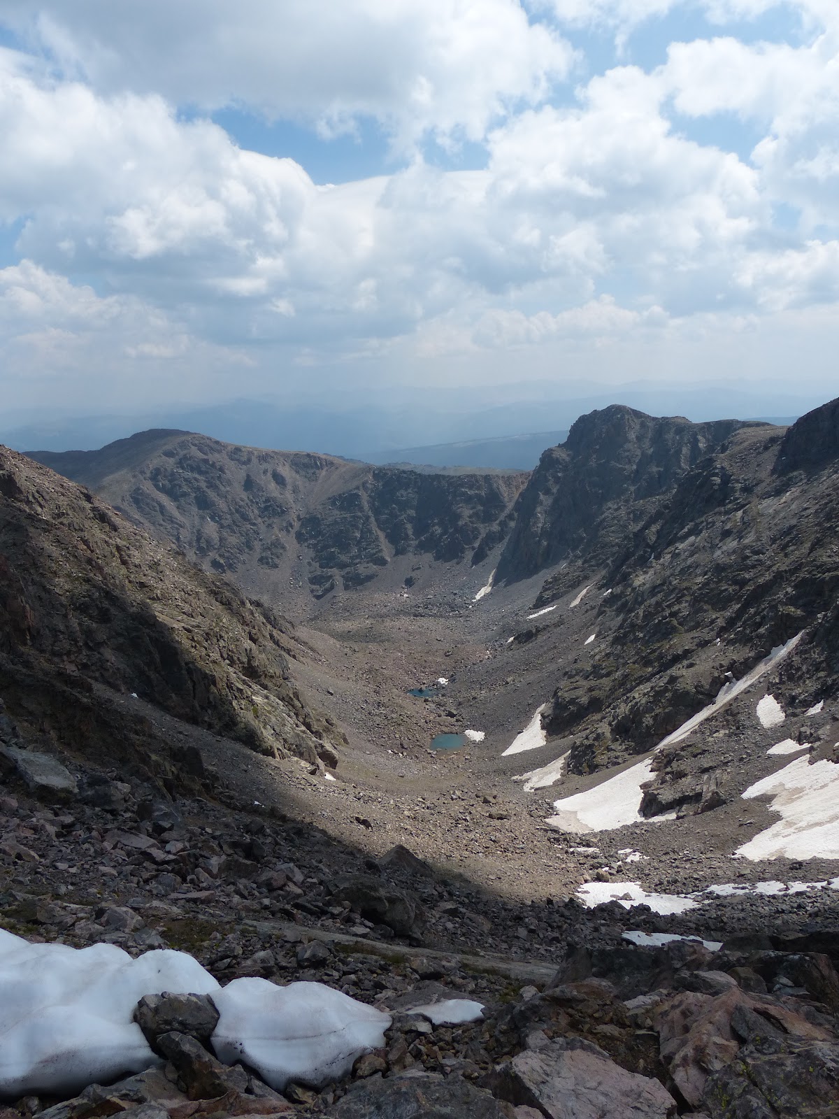
| Looking down the couloir between Holy Cross and Pt 13831 |
The above photo shows our ultimate goal. It is hard to make out.
The arrows shows the route we need to take to get to the shelter. Do you see the shelter?
Here is the above pic zoomed in.
The magnitude of our undertaking was starting to set in a little. Spirits were still high and we carried on.
 |
| Another look back at where we had come from. |
Since we were trying to avoid extra elevation gain, and went around Pt 13831 instead of over it, we nearly got fooled into following the wrong ridge line. But we popped out at the right spot. Below us to our right was Tuhare Lakes. Below us to our left was the Bowl of Tears.
 |
| Tuhare Lakes |
 |
| Lower Tuhare Lake |
 |
| Bowl of Tears |
 |
| Another view of Mt of the Holy Cross as we had come back around Pt 13831. We had descended off the left side and along the ridge line. |
The Bowl of Tears. I don't know where the name came from, but I might have an idea. Tears were close to being shed, as we had just spent 2 hours to get through 1 mile of rocks to get around Pt 13831. And we still had 2 more small peaks to get over/around and endless amount of rock before reaching the shelter. This was a low point. There was a small discussion about maybe descending down to Tuhare Lakes and following Fall Creek out. That was nixed. Good thing as it would have put us below the trailhead. I was concerned about how much longer this was taking than anticipated. The weather was holding out, but we had been above treeline for a long time, and we weren't going to get back to treeline for a long while. The one thing that kept that fear from really becoming overly stressful is the new GPS watch I got before this summer. It has a built in barometer. I wanted this feature for days like this, so I could see if the pressure was falling, indicating the possibility of looming storms. The pressure had been holding steady the whole day. While there were quite a few
cumulus clouds, they weren't forming vertically into
cumulus congestus or
cumulonnimbus. Both these signs gave me some hope that we wouldn't get stuck in a thunderstorm.
We slowly descended to an area that flattened out and thankfully was more grass than rocks. For few moments, we could leisurely stroll without thinking about each foot placement, without worrying about a rock moving when we stepped on it. It felt great. And the views were fantastic. Spirits in the group rose. I felt a second wind and picked up the pace.
 |
| The group enjoys a respite from the rocks. |
 |
| Looking back at Pt 13831. We had descended through all that rock/talus to reach the less rocky high alpine grassy area. |
 |
| The traverse here was bit narrow, but had magnificent views. |
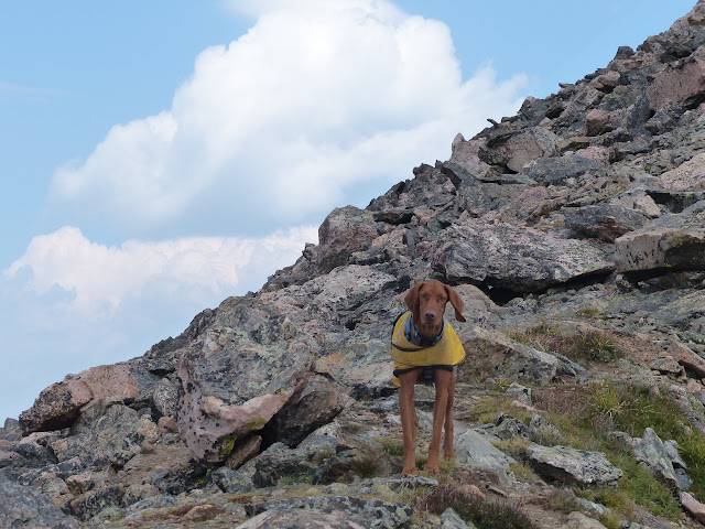
At this point we would hit more rocks. I was getting tired again and just focused on getting to the shelter. I put my camera in my pack and quit taking pictures. We had to climb over the unranked PT 13373. The climb up wasn't too bad, but the descent down got tricky and the pace slowed again. On the other side of PT 13373 was a curious set of obstacles. The exposure here was higher. This potentially was going to be tricky. Energy was lagging again. Even Rusty who had been phenomenal up to this point, was starting to hesitate in the talus. He was starting to whine and hesitate as he made his way through the rocks. Before, I had on a couple of occasions had to hold onto his harness and assist him as he jumped up or down a rock. But now, Weston or myself, had to completely lift him up or down a rock. We decided to just stay on the ridge and tackle the obstacle instead of dropping below them.
In the end, this section actually wasn't all that bad and again spirits of the whole group rose as we made pretty quick work of that section. The only thing that stood between us and the shelter was PT 13248, another ranked thirteener. There was a grassy slope to climb to near the top. I felt like we had finally gotten through all the hardships. We could again circumnavigate the summit, avoiding extra climbing and reach our destination.
But no, there was more rock. The shelter seemed so close, but another awful talus field awaited. At this point I just wanted to get to the shelter and trudged onward, dropping the rest of the group. And finally reached my goal for the past 5 and half hours. 5 and half hours to go 3 miles.
 |
| Notch Mountain Shelter |
Not that it was truly that important, but after all this time I wanted to go inside. There was a padlock on the door, but it wasn't locked. The door had a weird metal piece that I finagled with trying to get it to open. At one point I had pulled the metal piece completely out. All I wanted to do was get inside. I was tired. I wanted out of the wind. I wanted to sit and relax for a few moments. I got the metal piece back into the slot and eventually got the door opened. The door was locked with a simple latch the needed to be lifted. The metal piece lifted that latch, but it wasn't intuitive what to do without seeing the inside.
 |
| Shannon and Laurie make the final trudge across the last of the rocks to the shelter. |
We all regathered ourselves in the shelter. Rusty was falling asleep standing up, so I was a bit concerned I was going to have to carry him the final 5 miles. We had dodged one huge bullet, as the weather had held out all day. It really had been a perfect day. Our next concern was running out of daylight. I had left my headlamp in the car, as I was charging the batteries. No one else had brought one. So we didn't dally to long in the shelter before heading out.
 |
| Last look at the Mt of the Holy Cross, from the Notch Mountain Shelter. |
We took our last looks at Holy Cross. The picture above gives you a clue on the origins of its name. The snow in the couloir that runs vertically up the mountain, sticks around for a long time, due to this being on the north face of the mountain. Many times it will hold completely through the summer and to the first snow in fall. Near the top of the mountain, a small ledge runs horizontally across the face. This also tends to hold snow well into summer. Thus a large cross can be seen on the north face of the mountain. When the first pictures of the cross were seen by the public in 1873 it created quite a stir and would eventually inspire Henry Wadsworth Longfellow to write the poem the
Cross of Snow.
Thankfully, we would have a trail the final 5 miles. It initially descended down the slope of Notch Mountain in a series of switchbacks. As we descended, after being at 13000 feet for nearly 8 hours, everyone seemed to feel better with the lower elevation. Even Rusty bounced back and was happy to be off rock and run through grass and chase marmots. Which led me to having to put him back on leash. He had started the off the hike on leash, but for the most part had been off and been very good.
 |
| Descending as the sun began to set. |
 |
| Looking back up the descent off Notch Mountain. |
 |
| Evening falls over the valley. |
We finally reached treeline and kept chugging along. The trail ran above Fall Creek, which made us realize the good decision we had made many hours earlier and not descend down to the creek.
 |
| Fall Creek below us. |
We passed a waterfall and some downed trees along the way.
As the trail endlessly continued on, I was just mindlessly putting one foot in front of the other as Rusty, now back on leash, pulled me along. I was concerned about the coming darkness and wanted to get back to the trailhead as quickly as possible. For the second time of the day, I dropped the group. When I finally reached the trailhead, darkness had begun to settle in the trees. I walked down the road to the truck, drove it back to up to the trailhead, so the others wouldn't have to walk an extra step, grabbed my headlamp and headed back up the trail to meet the others and give them some light the last few hundred yards. Total time from start to finish, 13 hours, 23 minutes. Only about 5 hours longer than I had anticipated.
We were all pretty tired at the end. I still had to drive us back to the campsite. I knew I was tired as I thought I missed a turn, when I hadn't, and then did miss a turn that I knew was there. But we got back to the campsite safely and the group that hadn't joined us for the hike welcomed us back. We enjoyed some of my latest home brew, San Juan Summer Ale, recounted our adventure to everyone else and then I called it a day and crawled into my sleeping bag for a long night of sleep.
Sunday was a leisurely morning. Rusty was definitely sore and tired. After taking down tent and packing up, Laurie and I headed into Vail for its Sunday Farmer's Market. It was pleasant way to spend a few hours, before heading back to Boulder.
In the end, while it was a long day, it was worth the adventure. Rusty was great. He only got into a few spots where he got stuck or hesitant. Otherwise, he led the way the entire day. I was glad there was 4 of us on this trek, as at some point, we all had our low spots and needed the group to get us through. I think if was just 2 of us, things might have turned out differently. I also am glad the weather was good. Because I really made a poor decision in scouting out this route. Generally, I do a lot of research about routes before hand and have a good idea of what to expect. For some reason, I didn't realize/understand how long that 3 miles would take and how much rock/talus was involved. Personally, I wouldn't have minded that long a hike if I knew what it was going to be beforehand. I would have been mentally more prepared for being out for all day. I also think I struggled a bit more because I was tired going into this hike. It had been a busy week and I hadn't gotten enough sleep in on Wed and Thurs night. Which isn't good considering Fri night would be short night of sleep as well. I also felt badly for getting the group into this long hike based on my poor understanding of the route. Again, if everyone was well educated on the route and decided to go ahead, I would have felt better. The biggest thing is, if we knew how long it was going to be, and were going to go ahead and do it, we would have started much earlier.
At some point, I plan on re-visiting this area and hiking the last 5 miles we did, up to the Notch Mountain Shelter, when the cross is still visible on the face of the mountain. To see what Clarence King saw back in 1873. That would be a nice hike or run, without all that talus.
Full details downloaded from my watch
http://www.movescount.com/moves/move73971763